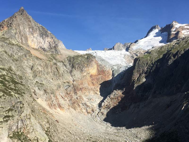
Morphology and geology
Mont Blanc, point of contact between the European and the African plates
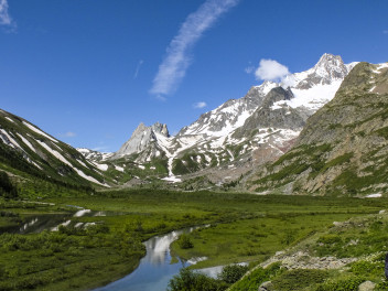
Mont Blanc extends from north-east to south-west in the north-western Alpine chain. It therefore evolves in complete harmony with the current direction of the internal powers of the Planet, that tend to bring the European plate closer to the African one, the latter represented by the Padana Plain. Mont Blanc therefore lengthens following the contact points of the continental plates. Its isolation derives from the fact that it rises in the middle of a region with prevailing subsidence. At the feet of the mountain, towards the Valle d'Aosta (Aosta Valley), is the underground sloped plain that caused the European plate to submerge under the Alpine chain. Towards Savoie the European continental crust folds like a mat when it slides against an obstacle. Pushed on its shoulders by the Aiguilles Rouges and blocked behind Mont Blanc, the Chamonix valley narrows following this disforming model.
Its diversity from the surrounding relief comes from the material it is made of. Its rock was formed from a bubble of magma in the overheated bowels of a continental plate. Even though a network of fractures runs through it, the massif maintains the cohesion of a rigid block. Answering the internal stress of the system, it did not crumble or fold like the sedimentary rocks around it, but only took on an almond shape.
The massif rocks
The rocks of a continental plate are often very old and/or recycled. In the European plate, Mont Blanc, which is made essentially from a nucleus of granite enveloped in gneiss, is no exception.
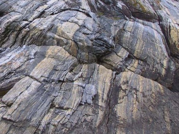
The Gneiss of the external shell derives from antique sedimentary rocks that deformed and rebalanced during the Palaeozoic period (from approx. 542 to 251 million years ago). This shell is preserved in the south-western part of the massif, starting from the top peak towards Aiguille des Glaciers and beyond, and also at the bottom of the Savoie and Vallesano side.
The rocks are crystalline and foliated, made essentially of quartz and feldspar, darkened here and there by higher concentrations of iron and magnesium.
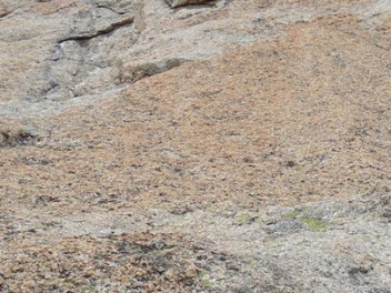
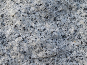
During the Carboniferous period (310 million years ago), a large part of this material overheated and melted. It subsequently cooled, creating a granite nucleus made of quartz, feldspar (at times large white potassic crystals with a rectangular section) and black mica, replaced here and there by greenish chlorite. In the same manner as the gneiss, the granite is marked by darker nodules, and is also intersected by clear threads made up of small feldspar crystals. Contact with the encasing gneiss can be identified halfway down the Savoie face at the height of Montenvers, and in Val Veny along the crest of Brouillard where it takes on the aspect of a brownish festoon.
The shapes
The part of Mont Blanc that is still protected by a gneiss shell presents more rounded and continuous shapes on which the normal roads for the peak have been traced. Where the granite appears on the surface, however, the relief is quite marked by fissures produced during the strain of rising. These fractures limit the pillars, spires and towers that have made the massif famous.
Massif rise and finishing
Around twenty million years ago the European plate met the African one, and ended up being submerged by the alpine plate that was, and still is, positioned between them. The rise of Mont Blanc began when the massif, which was inside the European plate, found itself on the edge of the immersion face. As a result of its size and relative lightness, it was undermined and pushed to the surface on the edge of the furrow, against the slopes of the alpine chain.
Inside the plate where Mont Blanc was (and still is, in part) buried, up to the 4807 m of its peak, the massif absorbed an enormous quantity of energy and heated somewhat, making fluids full of silica run into the fissures created by deformation. The treasures of the Savoie and Valdostana "cristalliers", the magnificent druses of quartz exposed at Chamonix, at Pointe Helbronner and in many world mineralogical museums were created by the slow crystallisation of these fluids.
While it was rising, Mont Blanc underwent various cycles of glacial accumulation on its peak and all the surrounding territory, up to the distant plains. Glacial cirques, thresholds and deep valleys were sculpted into its rock, large valleys deepened into the soft surrounding rocks. The large glaciers took the road of the deep depressions that already existed in this part of the Alps: the Rhone through Savoie, Lake Geneva through Vallese, the Padana Plain through the sloping gulley of the Dora Baltea. Immense quantities of rock and lime were torn from the mountain and deposited at the outlet in the plain; all the rocks along the run of the glacier were smoothed as can be seen today in the more solid and steady stretches of mountainside. The first alpine glaciations began 1.6 million years ago, while the current withdrawal has been lasting for just 10,000 years with some fluctuation. The last sensitive progress on the whole massif is dated 1820, followed by an almost continuous retreat.
Looking around Mont Blanc
The continental European basement (gneiss, mica schist, locally granite) and the sedimentary covering (marl, sandstone, Mesozoic limestone) make up the Savoie territory. To the south of Saint-Gervais the river digs through the covering formations until it discovers the basement that rises from Contamines at Prarion. At times the start of the carboniferous sedimentation is well exposed (Porménaz). The basement, however, which was pushed upwards by the recent (less than 20 million years) deformations of the European plate, appears above all in height: in addition to Mont Blanc, naturally, also in the Aiguilles Rouges, on the peaks of which remain shreds of sedimentary covering. The plate dominates in the rest of the alpine and pre-alpine Haute-Savoie, frequently in overlapping layers even from quite far away (Chablais).
The Swiss sector is divided between the European plate to the west and the metamorphic alpine layers on the east.
The latter are detached parts of various subsided layers, that were transformed and re-emerged during the alpine orogenesis. The Penninic Thrustfront, which marks the contact between these two geological worlds, follows Val Ferret and reaches the valleys of the Rhone towards Sion, not very visible on the surface.
From the European side the basement, softened in relief by the Quaternary glacier and cut by the Rhone, is exposed around Martigny. Mont Chemin, famous for its mines, is an extension of Mont Blanc. The carboniferous covering rises in the valleys of Trient and in the Eau Noire. The upper, therefore most recent (Mesozoic), layers closely follow the gulley that reaches Chamonix. More to the West, the Mesozoic covering appears at the Emosson lakes where the famous dinosaur prints were discovered.
Along Val Ferret and Val Veny the Mesozoic covering is detached, overturned and leaning almost vertically against the granite rock of Mont Blanc. A little more to the east, the Penninic Thrustfront materialises in a series of chalk white flows and black carbon schist that run along the bottom of Val Sapin and cross Chécrouit up to Val Veny. Beyond the Penninic Thrustfront, the metamorphic alpine layers can be seen initially by their muddy detritus, accumulated in this area that were low (Mont Blanc was not yet present) at the feet of the oldest Alps. Mud and gravel have now become schist gaps with limestone, mica and quartz (Licony, Crammont...).
More to the east, the low valleys of Drance and Dora in Valdigne intercept the slopes of the Great St. Bernard, with their black carbon schists that incorporate white crystalline bodies.
