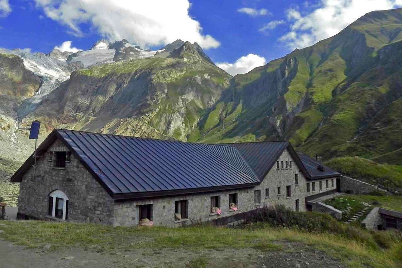
Rifugio Elena
Courmayeur - Arnouva (I)
Distance2,9 km
Difference in altitude 326 m
Duration 2 h
Difficulty Easy
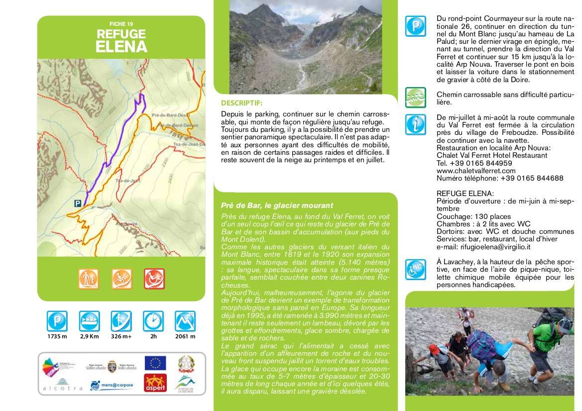
Description
From the car park, continue on the farm road, which climbs regularly to the refuge. Also from the square, there is the possibility of taking a spectacular panoramic path, which is however not suitable for people with walking difficulties, due to some steep sections and challenging passages, as well as the possibility of encountering snowfields in spring and in July.
Technical data
Place
Courmayeur - Arnouva (I)
Departure
Arnouva (Val Ferret)
Arrival
Rifugio Elena
Direction
Back and forth
Difference in altitude
326 m
Distance
2,9 km
Duration
2 h
Maximum altitude
2.061 m
Route conditions
Wide path
Difficulty
Easy
Photo gallery